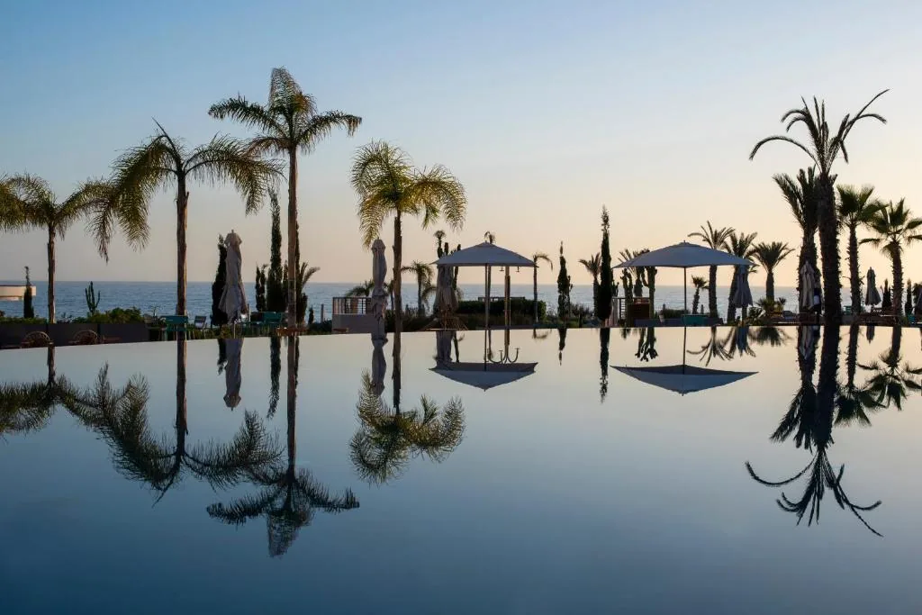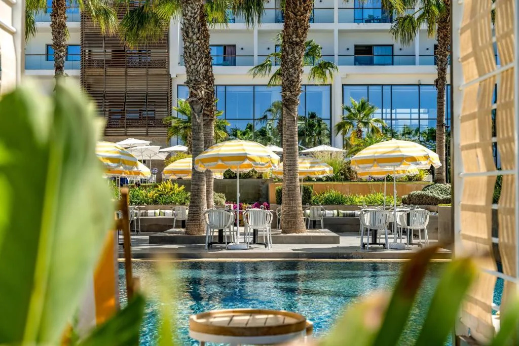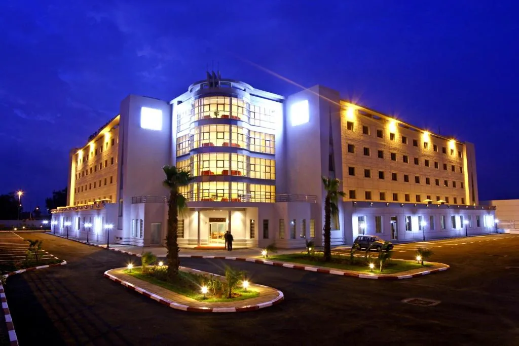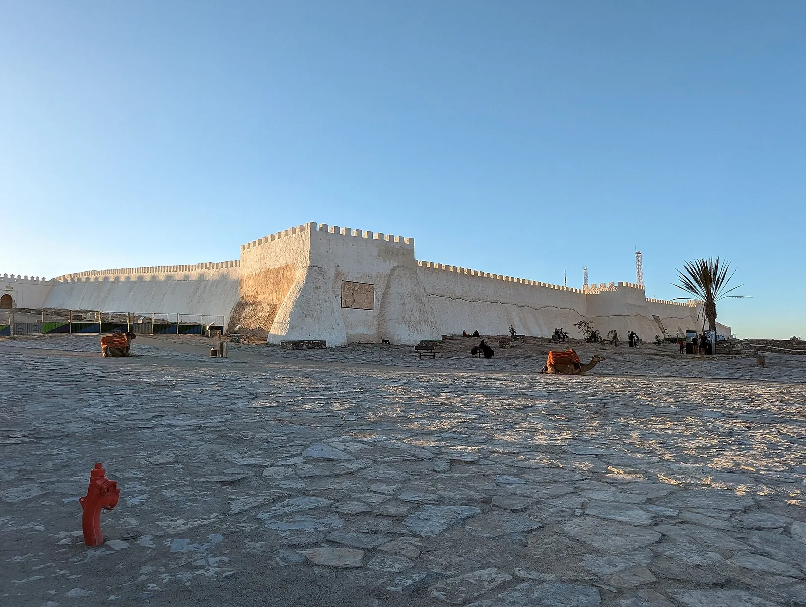
Agadir initially presents itself as a modern seaside resort. Its wide avenues, hotels, light-coloured buildings and long promenade overlooking the Atlantic seem to tell the story of a city focused on tourism and contemporary life. Yet this appearance reveals only part of its identity. To understand Agadir, you must also look at what has disappeared, the neighbourhoods destroyed by the disaster of 1960 and the surviving traces on the hill overlooking the bay.
Much of the city visitors see today is the result of reconstruction. The earthquake of 29 February 1960 destroyed a large part of the former settlement and profoundly changed the lives of its inhabitants. The new city was built slightly farther south, following modern urban planning principles. This break with the past explains why Agadir looks different from other historic Moroccan cities, where medinas, monumental gates and old neighbourhoods still form the heart of the urban landscape.
However, Agadir’s history did not begin in 1960. Long before becoming an international tourist destination, it was a strategic point on Morocco’s Atlantic coast, a fortified settlement contested by the Portuguese and Moroccan dynasties, and a trading port connecting the Souss region with Europe and the rest of Morocco. During the twentieth century, its name also became associated with a major episode in European diplomatic history.
Today, several places help visitors rediscover the different stages of this past: the Kasbah of Agadir Oufella, museums dedicated to the memory of the earthquake, cultural institutions and neighbourhoods in the modern city. These places cannot replace the old Agadir, but they help explain how a vanished settlement continues to shape the identity of the city today.
This guide traces the major stages in Agadir’s history, from the earliest references to its name to its transformation into a regional metropolis. It also introduces the places where visitors can discover its heritage, understand the 1960 earthquake and explore the connections between Agadir, the history of the Souss region and Amazigh culture.
1. Agadir: An Amazigh Name Associated with Fortifications
Before becoming the name of a major Moroccan city, the word “agadir” referred to a particular type of structure. In Amazigh languages, it can mean a wall, enclosure, fortified building or citadel. The term is also associated with collective structures used to protect goods, food supplies or resources belonging to a community.
This meaning helps explain the strategic dimension of the name. In a region where relief, valleys, trade routes and access to water have long influenced settlement patterns, fortified structures played an important role. The name Agadir therefore evokes a world in which protection, territorial control and the preservation of resources were essential.
The full name commonly used for the historic fortress, Agadir Oufella, means “the fortress above” or “the upper fortress”. It refers to its commanding position on the hill overlooking the bay. The expression also distinguishes the citadel from the districts located lower down, near the seafront or on neighbouring plateaus.
The word “agadir” appears in several place names across Morocco. It does not refer exclusively to the Atlantic city in the Souss region. Its presence in different territories reflects the historical importance of fortified structures in the organisation of Amazigh societies.
For visitors, this linguistic background offers a first key to understanding the city. Agadir is not simply a port whose history was shaped by foreign powers. Its name belongs to an older Amazigh heritage that connects the site to a regional history extending far beyond the boundaries of the modern urban area.
Amazigh culture remains an essential part of the Souss region’s identity. It can be seen in local languages, traditional crafts, music, jewellery, agricultural practices and the historic relationships between villages in the hinterland and regional urban centres.
To explore this cultural dimension further, read our guide to Amazigh culture in the Souss region.
2. Before the Portuguese: A Strategic Position on the Atlantic
Agadir’s documented history is closely connected to that of the Souss region, which has long maintained links with inland Morocco, caravan routes and Atlantic trading networks. The bay forms a point of contact between the coastline and the territories south of the Atlas Mountains.
An early map dating from 1325 mentions a place in the region called Porto Mesegina, a name associated with the Mesguina tribe. This reference shows that navigators and cartographers were already interested in this part of the coast long before the establishment of the Portuguese settlement.
Historical sources subsequently mention a locality known as Agadir al-Harba, recorded at the beginning of the sixteenth century. The available evidence does not always make it possible to reconstruct the settlement’s organisation, population or commercial activities in precise detail. Nevertheless, the site clearly possessed geographical and strategic importance.
The Souss region occupied a distinctive position within Morocco’s trading networks. It connected agricultural areas, mountain territories, production centres and routes leading towards the coast. Products from the hinterland could be transported to ports, while goods arriving from abroad entered regional commercial networks.
Being close to the ocean was not enough to guarantee a port’s prosperity. Security in the bay, control over access, relationships with surrounding populations and political decisions also played decisive roles. The future city of Agadir stood at the intersection of these different interests.
From the fifteenth century onwards, European powers sought to consolidate their presence along the Moroccan coast. Portugal occupied several strategic positions as part of its maritime and commercial expansion. Ports helped secure shipping routes, facilitate trade and support the Crown’s political ambitions.
Agadir Bay consequently became an important point of control. Its location made it an attractive base on the Atlantic coast, but its occupation soon encountered resistance from local populations and regional authorities. The city entered a period of military and commercial rivalry that would transform its future.
3. 1505–1541: Santa Cruz do Cabo do Gué and the Portuguese Period
In 1505, the Portuguese nobleman João Lopes de Sequeira established himself in the bay and built a wooden castle at the foot of a hill, close to a spring. This marked an important turning point in the history of the site. The settlement became known as Santa Cruz do Cabo do Gué, a Portuguese name referring to Santa Cruz and the cape.
The location was chosen for practical and strategic reasons. A nearby water source was essential for maintaining a permanent settlement, while the hill provided an elevated position from which to observe the surroundings and defend the site.
Portuguese activity was not limited to the construction of a single fortress. It formed part of a broader strategy to control key points along Morocco’s coastline. Portuguese authorities sought to strengthen their maritime presence, protect commercial interests and establish positions capable of resisting local opposition.
The castle was purchased by the Portuguese Crown on 25 January 1513. This acquisition confirmed the importance of the settlement to Portugal’s strategy along the Moroccan Atlantic coast.
The memory of the Portuguese period survives partly in the name Founty, a district near the seafront. The place name is generally associated with the Portuguese word fonte, meaning “spring” or “fountain”. It recalls the importance of the water source near the original settlement.
A foreign presence met with resistance
The Portuguese occupation provoked hostility among the populations of the Souss region. Control of a port was not simply a military matter: it also affected commercial exchanges, the movement of goods and the political balance of the region.
For several years, local forces organised an economic and military blockade. This pressure restricted supplies and weakened the Portuguese position. Despite its defences, the settlement depended on its relationship with the surrounding territory.
The struggle for Agadir took place during a period of political change in Morocco. The Saadian dynasty was gradually strengthening its authority and seeking to limit foreign settlements along the coast. The hill overlooking the bay became a decisive element in this confrontation.
In 1540, the Saadian sultan Mohammed ech-Cheikh established positions on the heights above the fortress. He had artillery installed there in preparation for an assault on the Portuguese settlement. The terrain gave the attackers a military advantage: from the heights, they could put direct pressure on the defences below.
The siege began on 16 February 1541 and ended in a Moroccan victory on 12 March. Around six hundred Portuguese were taken prisoner, including the governor Guterre de Monroy and his daughter, Dona Mecia.
The recapture of Agadir was a major event in the region’s history. It demonstrated that Portuguese control over Morocco’s coast was neither uniform nor irreversible. Foreign settlements remained vulnerable when local populations and political authorities organised sustained resistance.
Following the defeat, Portugal abandoned several of its Moroccan positions. Agadir, Safi and Azemmour were among the places it lost. By the middle of the sixteenth century, Portuguese possessions had been considerably reduced, although Mazagan, Tangier and Ceuta remained under Portuguese control at that time.
This period is fundamental to understanding Agadir’s history. It explains the military importance of the hill and the city’s role in the rivalries between European powers and Moroccan dynasties. The Kasbah remains the main place where visitors can relate this history to the surrounding landscape.
4. The Saadian Kasbah: A Fortress Above the Bay
After the victory of 1541, the former Portuguese settlement remained unoccupied for several years. However, the hill did not lose its strategic importance. Its elevated position continued to offer an advantage for monitoring the coast and controlling access to the bay.
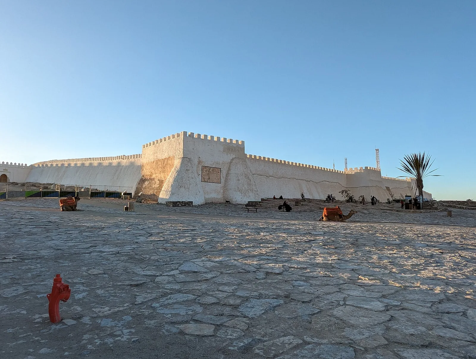
During the reign of Sultan Abdallah al-Ghalib, from 1557 to 1574, a new fortress was built at the summit. It became the Kasbah of Agadir Oufella, today one of the most important surviving witnesses to the city’s early history.
The fortress occupies a hill from which much of the bay can be observed. From its heights, visitors can look out over the ocean, beach, port and modern urban area. This commanding position explains the site’s importance for defence and territorial control.
However, the Kasbah was more than a military installation. Before the 1960 earthquake, it was a populated neighbourhood with communal facilities and places of worship. It included a large mosque, a hospital, a Jewish quarter and several shrines. Daily life therefore unfolded within a fortified area that combined defensive, religious and residential functions.
This is an important point: the Kasbah should not be reduced to its walls. The hill was home to a community and to a collection of places that helped organise the city. The surviving structures are the remains of a vanished urban district, not simply an isolated fortress.
The Kasbah was classified as a historic monument in 1932. Restoration work followed in 2002, with a further renovation phase in 2020. These interventions reflect efforts to preserve what remains of old Agadir and make the site accessible to visitors.
Visiting Agadir Oufella today
A visit to the Kasbah offers one of the clearest ways to understand Agadir’s historic geography. The hill provides remarkable views over the bay and the modern city. It also allows visitors to appreciate the distance between the former urban centre and the neighbourhoods developed after 1960.
It is important to remember, however, that the surviving ruins represent only part of what existed before the earthquake. The disaster profoundly altered the site, and the visible remains alone cannot recreate the entire historic neighbourhood.
For a more complete visit, consider combining the Kasbah with a museum dedicated to the city’s memory. This allows you to connect the landscape and architectural remains with historical documents and photographs.
Find more information in our Agadir Oufella Kasbah guide.
5. From the Seventeenth to the Eighteenth Century: Agadir as a Trading Port
Following the Portuguese period and the construction of the Saadian fortress, Agadir gradually regained an important commercial role. During the seventeenth century, under the influence of the Tazerwalt dynasty, the port became a point of exchange between the Souss region and several European markets.
Trade included sugar, wax, copper and hides. European weapons and textiles entered the region in return. These goods illustrate the diversity of the port’s commercial relationships with overseas markets.
Agadir did not necessarily possess the infrastructure of a major modern port. Loading and unloading took place under conditions very different from those of contemporary harbour facilities, without a substantial quay comparable to modern installations. Nevertheless, the bay played an important economic role because of its location and connections with the hinterland.
A port’s prosperity depended on several factors: political stability, the security of trade routes, overseas demand, the availability of supplies and decisions made by the authorities. Agadir stood at the centre of these changing relationships, but remained vulnerable to shifts in power and natural disasters.
During the eighteenth century, an earthquake destroyed the town, according to historical chronologies commonly reported for the period. The year 1731 is sometimes given in the sources consulted, although the details of this earlier disaster should be distinguished from the much better documented events of 1960.
The destruction weakened the settlement and contributed to a reassessment of its commercial role. In this context, the port was ordered to close in favour of Essaouira, which became an important centre for maritime trade under Sultan Mohammed ben Abdallah.
This shift had lasting consequences. Trade, investment and the movement of goods were redirected towards another port. Agadir gradually lost some of its economic importance and entered a long period of decline.
This phase reminds us that the city’s history was not one of uninterrupted growth. Its development depended on political decisions, competition between ports and natural conditions. The site had benefited from its strategic location, but could also lose its importance when trade routes and government priorities changed.
6. From 1760 to the Late Nineteenth Century: A Long Period of Decline
From 1760 onwards, Sultan Mohammed ben Abdallah gave priority to the development of Essaouira. This decision was linked partly to efforts to strengthen control over maritime trade and reorganise relations between the central government and the southern territories.
The Souss region experienced political tensions. It had opposed the sultan’s authority, and the redirection of commercial activity contributed to Agadir’s declining importance. For almost a century and a half, the city failed to recover the commercial dynamism it had enjoyed during some earlier periods.
Accounts by European travellers provide an indication of this decline. In 1789, a traveller described a nearly deserted town where only a few ruined houses remained. In 1884, Charles de Foucauld portrayed Agadir as a poor, sparsely populated village with little commercial activity, despite its white enclosure walls giving it the appearance of a town.
These accounts need to be understood in context. They offer an outsider’s perspective on Agadir during a period of decline, but they do not fully describe the lives of local residents or the region’s connections with surrounding territories. A town can lose its importance as a port without all human activity disappearing.
In 1881, Sultan Hassan I ordered the port to reopen for trade. The decision was linked in part to the need to supply military expeditions in the south, particularly those undertaken in 1882 and 1886. The port thus regained a role connected with the Moroccan authorities’ presence in the region.
This reopening did not immediately restore the prosperity of earlier centuries. Agadir remained a relatively small settlement whose development depended heavily on political decisions and Morocco’s changing economic circumstances.
By the end of the nineteenth century, its future was still uncertain. The site retained its geographical and strategic value, but it did not yet possess the infrastructure that would turn it into a modern city during the twentieth century.
This long period of decline is essential to understanding Agadir’s trajectory. Before becoming an industrial port and tourist destination, the city experienced centuries of rivalry, commercial change and difficulty. Its contemporary development was not simply a continuation of an ancient period of prosperity: it marked a new phase shaped by Morocco’s political transformations and the modernisation of infrastructure.
7. 1911: The Agadir Crisis and a Major Episode in European History
Agadir’s name became internationally prominent in 1911. That year, the city became the setting for a diplomatic crisis involving Germany and France, with the United Kingdom playing a decisive role.
On 1 July 1911, Germany sent the gunboat Panther into Agadir Bay. The German government justified its presence by citing the need to protect German interests and companies in the Souss Valley. The cruiser Berlin subsequently joined the naval presence.
The arrival of German warships at a Moroccan port triggered a strong international reaction. Behind the stated objective of protecting residents and commercial interests lay broader issues: European influence in Morocco, colonial ambitions and the diplomatic balance between the great powers.
France was seeking to strengthen its position in the country. Germany challenged aspects of this development and wanted guarantees and compensation. The arrival of German ships in Agadir turned a diplomatic disagreement into an international crisis.
The United Kingdom was concerned that a rival power might establish a strategic position on Morocco’s Atlantic coast. The crisis raised fears of a European armed conflict. Subsequent negotiations aimed to prevent escalation while resolving the dispute between the powers.
A Franco-German agreement was signed on 4 November 1911. Germany agreed not to oppose the establishment of French dominance in Morocco in exchange for territorial compensation in French Equatorial Africa. The agreement paved the way for a consolidation of French influence in the country.
In 1912, the French Protectorate was established in Morocco. French troops landed in Agadir on 15 June 1913, marking another turning point in the city’s history.
Why is the Agadir Crisis important?
The 1911 crisis demonstrates how Morocco had become a focal point of European imperial rivalries. A bay relatively distant from the main diplomatic centres became an international issue because of its strategic location and competition between the great powers.
It also shows that Agadir’s history cannot be understood solely at a local level. The city’s name became associated with an episode that influenced relations between European states and accelerated political changes in Morocco.
For visitors interested in history, the Agadir Crisis adds another dimension to the city’s story. The bay is not merely a seaside landscape: it was also the setting for diplomatic events whose consequences extended far beyond the Souss region.
8. From the Protectorate to the 1950s: The Birth of a Modern City
At the beginning of the French Protectorate, Agadir was still a relatively small settlement. In 1913, the Agadir Oufella and Founty areas together had fewer than a thousand inhabitants. The city gradually expanded around the port, commercial activities and new neighbourhoods.
A first jetty was built near Founty in 1916. After 1920, port infrastructure developed further. This strengthened the relationship between the city and the ocean and laid the foundations for the economic growth of the following decades.
On the plateau at the foot of the hill, the neighbourhood of Talborjt took shape. It became one of the principal districts of the old city, with its streets, shops and communal spaces. The working-class neighbourhood of Yachech appeared a few years later.
These districts played an important role in Agadir’s daily life before 1960. They housed residents engaged in different activities and contributed to the development of a more structured urban area. Their destruction during the earthquake remains one of the most significant aspects of the city’s collective memory.
Agadir and the Aéropostale
Around 1930, Agadir became a stop on the Aéropostale air-mail network, which helped develop air connections between Europe, North Africa and West Africa. The names of Antoine de Saint-Exupéry and Jean Mermoz are associated with this history of airmail aviation.
The air network strengthened Agadir’s position within contemporary transport systems. The city was no longer connected to neighbouring territories only through roads and the sea; it also became part of a new system of exchanges based on air travel.
Urban development
From 1930 onwards, a modern centre was designed according to plans associated with urban planner Henri Prost and his deputy Albert Laprade. The urban layout favoured a form opening towards the seafront, with a horseshoe-shaped plan. This model contrasted with older structures, whose organisation had developed according to different historical and defensive needs.
During the 1950s, urban development continued under the direction of Michel Ecochard. The commercial port, fishing, canning, agriculture and mining supported the city’s expansion. Agadir attracted new residents and gradually became an important regional economic centre.
Tourism also began to play a more visible role. The bay, climate and beach offered opportunities for development, although the city had not yet reached the scale of tourism it would experience in later decades.
Agadir hosted the Grand Prix d’Agadir from 1950 to 1956, followed by the Moroccan Grand Prix from 1954 to 1956. These events increased the city’s international visibility and reflected its growing openness to new forms of leisure and public gathering.
In 1959, the port welcomed the yacht of Aristotle Onassis and his guest Winston Churchill. Agadir then had more than 40,000 inhabitants. The city was experiencing a period of growth that appeared to promise further economic and tourist development.
But this trajectory was abruptly interrupted on 29 February 1960. In a matter of seconds, the earthquake transformed the urban landscape and destroyed much of what had been built during the preceding decades.
9. 29 February 1960: The Disaster That Transformed Agadir
At 11:40 p.m. on 29 February 1960, a powerful earthquake struck Agadir. Its magnitude is estimated at around 5.8, but the epicentre’s proximity to the city and the earthquake’s shallow depth caused particularly destructive surface shaking.
The disaster occurred during Ramadan, on the third day of the month according to commonly reported chronologies. Much of the population was at home when buildings collapsed. Older neighbourhoods and several districts developed rapidly in the preceding years were especially badly affected.
The human toll was enormous. Estimates vary between sources, but the number of deaths is generally placed between 12,000 and 15,000. Tens of thousands of people were left homeless. For a city with a population of just over 40,000, the scale of the loss was immense.
The disaster destroyed hotels, apartment buildings, markets, offices and homes. Entire neighbourhoods were reduced to rubble. The Kasbah, already old and weakened, partially collapsed down the hillside. The districts of Founty, the Kasbah, Yachech and Talborjt were among the hardest hit.
According to commonly cited estimates, nearly 70% of the city was left in ruins. Streets and buildings that had structured daily life largely disappeared. Survivors faced the loss of relatives, the destruction of their homes and the disappearance of the familiar places that had defined their neighbourhoods.
Why was the destruction so extensive?
The severity of the consequences cannot be explained by the earthquake’s magnitude alone. The epicentre’s proximity to the city and the event’s shallow depth intensified the shaking at the surface.
Building conditions also played a major role. Part of the city’s rapid expansion between 1945 and 1955 had taken place without sufficient consideration of seismic risk. Many buildings, particularly in the most vulnerable districts, had not been designed to withstand shaking of this intensity.
Some earthen buildings collapsed and were reduced to dust by the earthquake. Other structures fell or suffered such extensive damage that they could no longer be used. The disaster exposed the vulnerability of much of the urban fabric.
The collapse of the Kasbah also carried symbolic significance. The site that had dominated the bay for centuries, bearing witness to the rivalry between the Portuguese and Moroccan dynasties, was itself struck by the disaster. The earthquake did not merely destroy homes; it also transformed the physical connection between the city and its history.
Rescue operations and evacuation
Following the earthquake, rescue efforts began under extremely difficult conditions. Rubble obstructed access to buildings and complicated the search for survivors. The Moroccan army took part in the response, alongside French and American military resources. French and American military aircraft and the US Navy contributed to rescue operations.
King Mohammed V called on cities across Morocco to send assistance. National solidarity played an important role in responding to the disaster. The needs were immense: locating survivors, treating the injured, providing water and food, organising shelters and reducing health risks.
Two days after the earthquake, the evacuation of the city was organised to help prevent epidemics and reduce the dangers created by the sanitary situation. Residents had to leave an area that had become largely uninhabitable, while authorities assessed the extent of the destruction and the possibilities for reconstruction.
A vanished city, a memory that remains
The 1960 earthquake marked a profound break in Agadir’s history. Survivors sometimes lost their homes, businesses, neighbours and the places that structured their daily lives. The destroyed neighbourhoods were not merely areas on a map: they represented family memories, everyday routines and communities.
The disappearance of the old city explains why memory plays such an important role in Agadir’s heritage. In other Moroccan cities, visitors can follow historical development through preserved old streets, gates, houses and monuments. In Agadir, much of this continuity was interrupted.
A visit to the surviving remains should therefore be complemented by museums and memorial spaces. Photographs, archives, testimonies and historical documents help reconstruct a city whose physical landscape has been profoundly altered.
To understand this history more fully, combine a visit to the Kasbah of Agadir Oufella with the Agadir Reconstruction Museum.
10. Reconstruction: Building a New Agadir
Following the disaster, an essential question arose: should the city be rebuilt on its ruins or relocated to a new site? The chosen solution was to develop the new Agadir approximately 1.6 kilometres south of the former settlement.
This decision permanently changed the city’s urban organisation. The new Agadir was designed according to modern principles, with wider avenues, structured spaces and an urban layout suited to the objectives of reconstruction. Relocating the centre helps explain the contrast between the remains of the old city and the contemporary landscape.
Several architects associated with the GAMMA group participated in the reconstruction, including Jean-François Zevaco, Élie Azagury, Pierre Coldefy and Claude Verdugo. Le Corbusier was also consulted. Architects and urban planners faced an exceptional challenge: rebuilding a destroyed city, accommodating a traumatised population and creating an urban environment capable of supporting new activities.
Reconstruction was not simply a matter of replacing destroyed buildings. It changed the city’s form, traffic routes, neighbourhood distribution and the relationship between residential areas, economic activities and the seafront.
The new Agadir gradually developed around the port, fishing, commercial activity, industry and tourism. The bay became one of the city’s greatest economic assets. Its beach, stretching for more than ten kilometres, helped make Agadir one of Morocco’s leading tourist destinations.
During the 1980s, the port became a major centre of the sardine industry, and Agadir was often described as the world’s leading sardine port. This reputation reflected the importance of fishing to the local economy and the city’s role in the processing and marketing of seafood.
Over the following decades, the urban area expanded. Agadir became a regional centre for services, trade, tourism, agriculture and port activities. The municipality had 504,768 inhabitants in the 2024 census, according to the figures cited for this administrative division.
Agadir is now a major contemporary city whose identity rests on several elements: its ancient history, the 1960 disaster, reconstruction, fishing, tourism and its links with the wider Souss region.
Architecture that tells the story of reconstruction
Agadir’s modern architecture is often less familiar to visitors than its beaches. Yet it represents an important chapter in twentieth-century history. The avenues, residential complexes and buildings of the new city reflect the determination to rebuild quickly while rethinking the organisation of the urban environment.
This architecture should not be regarded merely as functional scenery. It expresses a response to a disaster and the need to create a new living environment. Agadir’s heritage therefore includes not only structures dating from before 1960, but also the history of reconstruction and the decisions that shaped the city visitors see today.
To plan your visit, read our complete guide to Agadir.
11. Where to Discover Agadir’s History Today
A visit to Agadir can be built around several complementary places. Some help visitors understand the city’s historic geography; others preserve the memory of the earthquake or present collections connected with regional art and culture.
The Kasbah of Agadir Oufella: The Great Witness to the Old City
The Kasbah stands on the hill overlooking the bay. It is the place most directly associated with Agadir’s early history. Its fortifications recall the military struggles that shaped the site, from the Portuguese period to the construction of the Saadian fortress.
The visit offers views across the bay and helps explain why the hill was strategically important. The contrast between the panoramic landscape and the remains of the old fortress also highlights the scale of the changes caused by the earthquake.
It is important to remember that the visible walls do not recreate the entire historic Kasbah. Before 1960, the hill contained a living neighbourhood with religious spaces, communal facilities and homes. The earthquake destroyed much of this complex.
The Kasbah was classified as a historic monument in 1932. It was restored in 2002 and renovated again in 2020. For historical context and practical information, see our Agadir Oufella Kasbah guide.
The Agadir Reconstruction Museum: Understanding the Earthquake
Inaugurated on 27 February 2025, the Agadir Reconstruction Museum is housed in the former headquarters of Bank Al-Maghrib. It traces the history of the 1960 disaster and the reconstruction that followed.
Photographs, videos and archives help visitors understand what the city looked like before the earthquake, the extent of the destruction and the efforts required to build a new urban area. The museum is an essential complement to the Kasbah because it helps recreate part of the vanished urban landscape.
For visitors who want to understand Agadir beyond its seaside image, this is a particularly important stop. It places the modern city in its recent history and helps explain the human significance of the disaster.
The earthquake’s memory cannot be reduced to statistics. It concerns families, neighbourhoods, economic activities and social ties that were disrupted. The archives and documents preserved by the museum provide a way to approach this human dimension.
Find more information in our Agadir Reconstruction Museum guide.
Agadir Art Museum: Discovering Regional Collections
Inaugurated in 2023, Agadir Art Museum presents collections connected with regional heritage, particularly jewellery and carpets, alongside a donation of modern and contemporary artworks.
The museum broadens the visitor’s understanding of the city beyond military history and the 1960 disaster. Traditional objects reveal skills and traditions developed throughout the Souss region and neighbouring areas. They also help explain the connections between the city, the villages of the hinterland and Amazigh cultures.
Jewellery, textiles and artworks provide insight into materials, techniques, uses and aesthetic traditions. They remind visitors that a region’s heritage is not limited to monuments: it also includes objects, skills and practices passed down through generations.
For more information, see our Agadir Art Museum guide.
Olhão Garden: A Connection with Portugal
Opened in 1992, Olhão Garden takes its name from the Portuguese city twinned with Agadir. The garden recalls the relationship between the two cities and, more broadly, the historical links connecting Agadir with Portugal since the period of Santa Cruz do Cabo do Gué.
The garden offers a different way of approaching history. Unlike the Kasbah, it is not a surviving remnant of the Portuguese period. Instead, it is a contemporary place of remembrance and friendship between two cities whose histories have been connected through maritime activity.
A visit can be combined with other cultural stops in the modern city to understand how Agadir preserves and reinterprets different periods of its past.
Souk El Had: A Symbol of the Rebuilt City
Souk El Had is one of the most representative places in Agadir’s everyday life. Rebuilt after the earthquake, it is organised around a grid of perpendicular streets that makes it easier to move between different commercial areas.
The souk reveals another dimension of heritage: trading practices, regional products, craftsmanship and exchanges between the city and its hinterland. It is a lively place where residents buy food, everyday goods, clothing and handmade products.
Unlike the Kasbah, Souk El Had does not directly preserve the old city destroyed in 1960. Instead, it tells the story of Agadir’s ability to rebuild its meeting places and maintain an active commercial life after the disaster.
To plan your visit, see our Souk El Had guide.
12. Agadir and the Heritage of the Souss Region: A History Beyond the City
Agadir cannot be fully understood without considering the surrounding territories. It is the main urban centre of the Souss region, whose history, landscapes and activities are closely connected to agriculture, craftsmanship, the Anti-Atlas Mountains and routes leading inland.
The heritage of the Souss can be seen in Amazigh traditions, villages, building techniques, silver jewellery, carpets, agricultural products and culinary practices. It also includes landscapes and historic sites that reveal the relationships between communities, resources and trade.
The argan tree, for example, plays an important role in the region’s economy and landscape. Argan oil has become an emblematic product, but its history is also connected to agricultural practices, local expertise and the activities of rural communities.
Silver jewellery is another important element of regional heritage. It reflects craft traditions and local identities found in towns and villages throughout the hinterland.
Food also offers a way to explore the region’s history. Sardines, amlou, tagoulla and agricultural products illustrate the diversity of the Souss’s resources and culinary traditions. To learn more, read our guide to food in Agadir and the Souss region.
Excursions also reveal landscapes and settlements that complement Agadir’s history. Taroudant, Tiznit, Tafraout, the Ammeln Valley and Sidi Ifni each have distinct heritage, but all contribute to understanding the diversity of the region.
- Tafraout and the Ammeln Valley: rock formations, villages, almond trees and Anti-Atlas landscapes.
- Tiznit: the medina, ramparts and silver jewellery traditions.
- Sidi Ifni: Art Deco architecture and the history of the former Spanish enclave.
- Excursions from Agadir: ideas for exploring the Atlantic coast, hinterland and mountains.
These destinations show that Agadir is both a city facing the ocean and a gateway to a much wider cultural and geographical region.
13. How to Plan a Historical Visit to Agadir
To discover Agadir’s history, it is worth looking beyond the beach and tourist districts. A visit organised around the Kasbah, museums and urban centre helps explain the different stages of the city’s development.
Half a day: The Kasbah and the Bay
Start at the Kasbah of Agadir Oufella. Take time to observe the hill’s position, the bay, the port and the extent of the contemporary city. This first stop helps explain the site’s strategic importance and allows you to visualise the relationship between the old and new urban areas.
Continue towards the seafront. The contrast between the open spaces of the modern city and the remains on the hill helps illustrate the transformation of the urban landscape after 1960.
This option suits travellers with limited time who still want to discover an essential part of Agadir’s history.
One day: The Fortress, Memory and Urban Life
For a more in-depth visit, spend the morning at the Kasbah and the afternoon at the Agadir Reconstruction Museum. This combination connects the surviving remains with the documents and images that tell the story of the disaster.
Depending on your interests, add a stop at Agadir Art Museum or Olhão Garden. These places introduce regional culture and the historical relationship between Agadir and Portugal.
Finish at Souk El Had to experience a major commercial space in the rebuilt city. This visit takes you from ancient history to everyday practices and contemporary life.
Two days: Agadir and Its Hinterland
If you have two days, devote the first to the city’s history and the second to an excursion in the surrounding region. Tiznit offers a historic medina and traditional crafts; Tafraout introduces the landscapes and culture of the Anti-Atlas; Sidi Ifni reveals an architectural heritage and a history distinct from Agadir’s.
This itinerary shows that the city’s history is part of a broader regional story. The port, roads, markets and craft traditions have always connected Agadir with its hinterland.
Plan your itinerary with our guides to Agadir in one day, Agadir in two days and excursions from Agadir.
14. When Is the Best Time to Visit Agadir’s Heritage Sites?
Agadir generally enjoys a mild climate, making it possible to explore the city throughout the year. For a heritage-focused visit, the best time depends mainly on temperatures, wind, tourist numbers and how much time you plan to spend on excursions.
Spring and autumn often provide pleasant conditions for visiting the Kasbah, exploring the city and travelling into the hinterland. Temperatures are generally more moderate than in the height of summer, making outdoor visits and walking easier.
Summer attracts many visitors who come for the beach and seaside activities. The city can be busier, especially during holiday periods. Historical visits remain possible, but it is useful to plan outdoor activities around the hottest parts of the day.
Winter can also be suitable for a cultural trip. Weather conditions vary, and excursions into the mountains or rural areas require checking the forecast and road conditions.
Whatever the season, bring water, comfortable shoes and sun protection. For excursions, check distances, travel times and return arrangements. The landscapes of the Souss and Anti-Atlas can differ considerably from those along the seafront.
15. Practical Tips for a Successful Visit
Allow enough time. The Kasbah, museums and Souk El Had tell different parts of the story. If you want to understand the city’s development, avoid squeezing everything into a rushed visit.
Combine surviving remains with historical documents. The Kasbah’s ruins show the physical traces of the past, while photographs and archives help recreate the vanished neighbourhoods. Both approaches are complementary.
Consider the terrain. The Kasbah is located on a hill. Depending on access conditions and the type of visit, wear comfortable shoes and check practical information before setting out.
Respect places of memory. The 1960 earthquake remains a deeply painful event in Agadir’s history. Visits to museums and surviving remains should be approached thoughtfully, remembering that they preserve the memories of residents and their families.
Discover regional culture. Agadir’s heritage is not limited to the Portuguese period or reconstruction. Amazigh traditions, craftsmanship, food and connections with villages throughout the Souss are integral to local identity.
Check opening hours and access conditions. Visiting arrangements for monuments and museums may change. Before travelling, consult the information available on the sites’ dedicated pages and relevant official channels.
Plan an excursion if your schedule allows. A day in the hinterland offers a complementary perspective on the historical connections between Agadir, the mountains, trading towns and craft traditions.
To complete your preparations, visit our Agadir destination page and our complete guide to Agadir.
Conclusion: Agadir, a City Whose History Lies Between Ruins and Reconstruction
Agadir’s history is the story of a strategic site, a trading port, a contested fortress and a modern city profoundly marked by a disaster. From the earliest references to the region to the Portuguese presence, from the Saadian Kasbah to commercial decline, from the 1911 diplomatic crisis to twentieth-century urban development, each period has contributed to shaping its identity.
The earthquake of 29 February 1960 caused an extraordinary rupture. It destroyed much of the city, claimed thousands of lives and transformed the urban landscape. Reconstruction, carried out slightly farther south, created a new Agadir that would become a major regional economic centre and tourist destination.
Yet the old city has not entirely disappeared from collective memory. The Kasbah of Agadir Oufella, museums, art collections and everyday spaces in the new city help preserve different aspects of its history. They remind us that heritage is not made up solely of preserved monuments: it also includes archives, memories, skills and rebuilt places.
Exploring Agadir from this perspective means looking beyond its image as a seaside resort. It means discovering an Amazigh city facing the Atlantic, shaped by commercial exchanges, international rivalries, the memory of an earthquake and the determination of its residents to rebuild their living environment.
To continue exploring, read our guides to Agadir in one day, Agadir in two days, excursions from Agadir and Amazigh culture in the Souss region.
Read also
- Agadir in One Day: an itinerary from the Kasbah to the beach.
- Agadir in Two Days: explore the city and plan an excursion in the surrounding region.
- Excursions from Agadir: Taroudant, Tiznit, Tafraout, Sidi Ifni and the Atlantic coast.
- What to Eat in Agadir and the Souss Region: sardines, amlou, tagoulla and local products.
- Amazigh Culture of the Souss: argan, silver jewellery, music and museums.
- Tafraout and the Ammeln Valley: painted rocks, almond trees and Anti-Atlas landscapes.
- Tiznit: medina, ramparts and silver jewellery.
- Sidi Ifni: Art Deco architecture and the history of the former Spanish enclave.
- Beaches and Surfing Around Agadir: Agadir, Taghazout, Imsouane and the southern coast.
- Agadir-Al Massira Airport: access, taxis, buses and practical tips.
Cover photo: Kasbah of Agadir Oufella, Mwintirew, CC BY-SA 4.0, Wikimedia Commons.